-40%
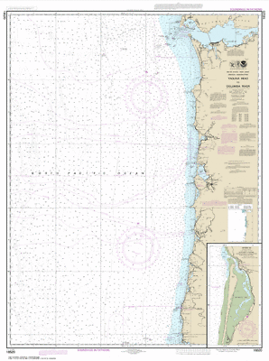
NOAA Yaquina Head Columbia River Tillamook Netarts Bay Oregon Paper Chart 18520
$ 14.22
- Description
- Size Guide
Description
NOAA Chart Yaquina Head to Columbia River; Netarts Bay 27th Edition 18520Detailed coverage of Yaquina Head to Columbia River; Netarts Bay. OceanGrafix provides mariners with the most up-to-date, NOAA-approved nautical charts ever offered. Charts are printed only after an order has been received, ensuring the most up-to-date information. All Notice to Mariners corrections are applied. Meets U. S. and international carriage requirements for commercial vessels. U. S. Coast Guard approved, Scale: 1:185,238, Dimensions Size (inches): 33.05 X 44.38 Ships rolled in a tube to protect against damage in transit.
Track Page Views With
Auctiva's FREE Counter
